Sunday 29 December 2013

Winter part 2: When people and avalanches mix

In my first winter post on avalanches I focused on the causes of snowpack instability and likened the structure to a very strange wedding cake. In this post the I want to focus on what it is like being caught in an avalanche, drawing on my own and my father's experience. 

Avalanche incidents in Scotland are not new; the Mountain Rescue Committee of Scotland's 'Survey of Scottish Avalanche incidents from 1980-2009' report gives a very interesting insight into the recorded causes, impacts and trends in avalanches over a 30 year period. The Scottish Avalanche Information Service (SAIS) publish annual reports on the previous winters avalanche incidents, these provide an interesting glimpse of the changes in weather, snowpack state over time, and the number of incidents. Both reports are well worth a read, if not to just bring some context to the way avalanches were reported on by the media following the very sad loss of life due to a number of avalanches in 2013. I don't intend to ramble on with my own views about the media's interpretation of mountaineering; best follow the link to these well written articles instead.

Here then is my report of being avalanched. To set the scene, it was the 7th January 2003, I had just turned 18 and was focusing (!) on my last couple of terms in the Upper Sixth. Dad was taking me on my first winter climb, the aim was a grade 1 gully called Jacob's Ladder in Coire an t-Sneachda in the Cairngorms.

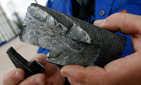
Photo and annotations of the avalanche site in Coire an t-Sneachda mid rescue. Photo credit: Alan Dennis (David Monteith collection)


A wee Monteith's  account of an avalanche 


The writing below is taken from an account I wrote immediately after the event, I have tried to change as little as possible save for a few minor grammar corrections. Included at the end is my fathers account of the day; as a retired geography teacher and MIC his account provides more context to the day than the ramblings of an 18 year old!

We started out aiming to do the above route. We walked into the main corrie from Cairngorm carpark to get to bottom of route where we took our sacs off and had a Snickers. Dad was on my right (facing the gully) when I heard him shout something like 'Alasdair, move right now', I looked up to see an avalanche and moved fast due to the urgency in his voice. I managed to move about three steps to the right and grab my sac when the first wave of snow hit me. Although I didn't really budge at first but saw snow all around, I was then hit by a slab which turned me over. My immediate thoughts were: *#%!, I'm not invincible, I might die; I'm going to hit my head so better put my hands over it, although I had no gloves on; where is Dad, I hope he is ok, I don't want him to die.

A sheer terrifying experience, I didn't want to believe it was happening, but it was, so face it and get on with it. I remember turning over several times and hoping I didn't get buried, I think I bounced off a few rocks before I stopped, hitting the bottom part of my spine. When I came to a stop I was about 6-7 ft up from Dad, with my rucksac just above and to the right of me. I was shocked, disorientated and sore. Dad had a cut to his head above his eye, relieved to see him alive but worried about his wounds.

I tried to move but couldn't and didn't think it was a good idea with my back, I couldn't get to my first aid kit as the bag was stuck solid in the snow and my hands felt as though they were frozen. Luckily, a team from Glenmore lodge and the Scottish Avalanche Information Service were nearby. They set about with first aid and radioed for a rescue. I was soon wrapped up in an orange bivy bag and covered with clothing. After only 40 minutes the helicopter, Rescue 137 from Lossiemouth (just across the field from the house!) arrived. It circled the corrie checking out the wind conditions and dropping a flare before lowering the winchman down and then the stretchers. It didn't take long to get us both hooked up to the stretchers and we were winched up into the cold. I was spun around by the rotor wash and was tipped up (a result of having my head at the wrong end of the stretcher as it turned out).


A welcome site: Rescue 137 ready to winch. Photo credit: Alan Dennis (David Monteith collection)

It only took around 15 minutes to get to Raigmore hospital in Inverness, during which we were given oxygen and checked over. Arriving at Raigmore, we were both placed in the same room which was reassuring. Being covered in warm towels after constant cold is a feeling I will never forget. I was also reassured when they decided not to cut away my new salopettes and jacket. I had about 6 X-rays taken of my neck, back and arm, but luckily nothing was broken. Dad's X-rays showed he had broken the top part of his hip and needed stitches to his head.

The next day was interesting. The press, tv and radio were in all day interviewing us.
I reckon we fell around 150-200ft and it may have been the initial impact that sent me flying onto my back and then around like a washing machine. Scary, but i'm going to carry on climbing.

Below is an extract of one of those news articles. As well as the Scotsman, Scottish Sun and Daily Mail I also made it into the illustrious pages of Sugar magazine, for which I received the pricely sum of £30. However, the editorial style of the article have cost me far more in jokes over the last 10 years!


The event, as reported by the Scotsman (click for larger view). Photo credit: David Monteith collection


15 minutes of teenage fame, Sugar Magazine, March? 2013.  Photo credit: Alasdair Monteith

The wise old wizard's account of the avalanche 


Below is my fathers account of the day and post event thoughts. This was originally printed in the Association of Mountaineering Instructors (AMI) magazine.

The 7th January 2003 dawned cold and crisp in the Cairngorms; it was a blue sky, high pressure day. My plan was to take my eldest son Alasdair on his first winter route in the winter tyros’s paradise, Coire an t Sneachda. We had already climbed a lot together in summer, the pinnacle of our experience so far being an ascent of Centurion the previous September, and we had spent lots of days in the winter mountains developing axe and crampons skills and looking at the special demands of navigating in the white stuff. The choice for Alasdair’s introduction to winter climbing was Jacob’s Ladder.

There had been the usual early season promise of a good winter with a heavy snowfall at the end of the previous October. In fact my log book records an ascent of The Messenger on the Mess of Potage on 26 October 2002! However the early snow had soon gone or been transformed to nevé in the nooks and crannies of the corries. Fresh snow fell on this old base in early January 2003, an extensive covering, which gave us a fairly strenuous walk into Sneachda that morning as the gentle but keen easterly wind filled in the previous day’s tracks. However, the avalanche hazard was 2 so we trudged up the approach path anticipating a good day.

An alarm bell rang when we met two climbers walking out – too much fresh snow and spindrift was their verdict. This was countered by another early riser exiting the corrie who had soloed Aladdin’s Mirror Direct and seen two skiers descend the Couloir. Things can’t be that bad then! We continued apace, following a deepening trench as we closed with the cliff and selected the right-hand of two beaten tracks through the soft snow. Up ahead several climbers were approaching the base of Jacob’s so I slowed down to see where they might go; they split and prepared to go left onto the Mess of Potage. We reached a platform prepared by the previous day’s teams and prepared to gear up.

In the eerie half light of an orthopaedic ward in the wee small hours you have a lot of time to think things through. Embedded freeze frame memories flashed through my mind: the crump as the avalanche released; the focused image of tons of snow breaking into slab above us; the cry ‘run right’ as I tried to steer us out of its path; the seemingly gentle push as the snow reached us, rapidly turning into a chaotic, tumbling motion; the blood on the snow when we finally stopped; the friendly banter with our rescuers as we waited for the Sea King to ferry stretchers to the rescue site; the hypnotic slow motion of the spiralling stretcher and the raw power of the Sea King’s rotor above as I was winched up. All of this impregnated with huge relief that we had survived albeit with bruises, breaks and scrapes; I had not been the agent of my son’s death.


SAIS, Glenmore Lodge staff and a young Monteith waiting for the Sea King. Photo credit: David Monteith collection

Through an amazing set of circumstances we later gained a detailed insight into what had happened. Basically we were caught by a build up of windslab over soft snow on the apron just below the entrance to Jacob’s ladder. When it released it swept the accumulated powder down onto us. We were gearing up on the edge of what became the debris fan and just missed getting out of its path. Unfortunately it took us onto rocks below, hence the scrapes and bumps!

Our luck held in the form of a Glenmore Lodge party, the group we had seen climbing towards Jacobs’s Ladder. Within minutes one of the Lodge staff was on the radio back to Glenmore and the soothing tones of Tim Walker penetrated the static in reply; the helicopter was scrambled from RAF Lossiemouth after only 15 minutes. Two SAIS forecasters were up on Windy Col assessing the snow and they also swept down on skis to assist, capturing the scene on camera as they descended.

The SAIS forecasters later passed on the snow profile for the day, which clearly shows a very weak layer at 20cms, the windslab above and soft snow beneath on the old snow base – the snow that had fallen the previous October, by January it was a perfect sliding surface. There was also a temperature unconformity at about 12 cms reflecting the windblown snow being brought in on a cold SE wind. Despite the avalanche hazard being 2 the build up of windslab on the apron on top of the very soft powder was significant.

Two weeks later during a pre-arranged visit to the Aeronautical Rescue Co-ordination Centre at RAF Kinloss we were able to view the archived plot of the rescue. It took less than 2 hours from avalanche to landing on at Raigmore prior to being admitted to A & E. We also visited the SAIS office to discuss the event and later met with them and some of our rescuers in the Bridge Inn to say thank you. The conclusion was that the wind had subtly changed overnight, loading the particular aspect by Jacob’s Ladder but there was no obvious cause to the release, it was just spontaneous.

One of the more bizarre aspects of the experience was the media interest. When we landed at Raigmore a battery of press photographers were waiting to snap our arrival. I was barraged by requests for interviews and after a hospital manager negotiated a delay to inform next of kin we were interviewed by local TV and news reporters. The next day we were also major news across both tabloid and broadsheet national newspapers. For once they wanted a good news story

Within a few weeks Alasdair was running in his school cross country race. I was back on the hill in mid-March after eight weeks recovering from a cracked hip and twelve stitches in my head. It was a salutary lesson that despite checking weather forecasts and avalanche information and being aware on the approach you can still get caught out. This time we had been lucky.

Learning points

• Eke out every detail from the avalanche forecast.

• Beware pockets of slab accumulating on avalanche prone angles above you.

• Check below as well as above – the run out is important!

• Subtle changes in wind direction lead to a greater build up of slab on slightly different slope aspects.

• It’s worthwhile trying to get out of the way of the main bulk of the avalanche.

• Try to avoid being buried.

• If you are going to get avalanched try to do it in the vicinity of folk who know how to put a rescue together.

• SAR helicopters in the UK are second to none.

• Have a plan of what to say to the press.

• Location, location, location. Had I bought the 2nd edition of ‘A Chance In a Million’ I could have read a similar tale by Bob Barton (page 111). I now own a copy!


But 11 years on we are both still out and about climbing (and skiing!) in winter.

David Monteith (Left) and Alasdair Monteith (right) both on South Gully, Cwm Idwal, IV 5.  31 years apart: 1982 and 2013. Photo credits: Arthur Collins and Dougie Maudsley

Tuesday 24 December 2013

Flooding: Shropshire 24th December 2013

The last few days have seen yet another round of winter storms bring wind, rain and misery to the British Isles, from Cornwall to the NW of Scotland. This follows on from the storms at the beginning of December that included a storm surge affecting the east coast of England. I produced a Prezi (a fancy version of PowerPoint you can access online) on the storms as part of a geography lesson I delivered to year 8 and 9 pupils. You can access the presentation through this link.

The image below is a synoptic chart, produced on the 22nd December as a forecast for the 24th December. Synoptic charts contain a wealth of information about the weather, but it is worth looking at the black lines (isobars) which indicate the strength of the wind and the air pressure around the L. Lower pressure means a stronger storm!


Synoptic chart showing the weather system responsible for Tuesday's wet weather! Source MWIS.org.uk

I spent Tuesday morning looking at the impact of flooding in South Shropshire around Leintwardine and Ludlow.


Ordnance Survey screen print of the area around Leintwardine and Ludlow visited.

To understand the air masses that interact to bring us this weather I suggest watching this short clip from the Met Office. Unfortunately, it looks as though more stormy weather is on the way for Friday. The BBC has a good clip explaining what has caused these unsettled conditions, whilst the Environment Agency is the best source of information on areas at risk of flooding and how to get help.
Below are a few images snapped along the way. They were all taken between 11.00 and 13.15 on 24th December.


Looking North up the River Clun from above Shelderton. Photo: Alasdair Monteith


Looking south along the River Clun from above Shelderton. Photo: Alasdair Monteith


River Clun in full flow at Leintwardine. Photo: Alasdair Monteith
How NOT to drive in heavy rain and flood conditions. Just south of Craven Arms. Photo: Alasdair Monteith


Another shot of Leintwardine looking south across the bridge. Photo: Alasdair Monteith


Another example of how not to drive through flood water. Photo: Alasdair Monteith
River Clun in Leintwardine, looking North. Photo: Alasdair Monteith


Flood waters at Ludlow. Photo: Alasdair Monteith


Thursday 28 November 2013

Winter Part 1 - wedding cake and avalanches anyone?

Around this time of year, when the first snows of autumn have covered the Cairngorms, Glencoe and even the Lake District (sort of), I start to switch my head into 'winter climbing, mountaineering and skiing mode' quite a change from 'summer rock climbing in the sun' which was pretty good this year despite the usual wet weather headlines. 


David Monteith enjoying early season conditions on Milky Way (III)
 Coire an Lochan, Cairngorms, November 2010. Photo: Alasdair Monteith

Such a change in activity requires more than just a cursory glance at weather forecasts and an idea of a venue (although the Mountain Weather Information Service is the place to go for reliable weather forecasts all year around for 8 mountain areas across mainland Britain).

Winter days in the mountains can bring some of the most rewarding and exhilarating experiences when stunning weather, good routes and excellent banter all come together. However, they can also bring fear, danger and worse - injury or death, if the cards are stacked against you and decisions don't go your way. 

From a geography point of view, winter presents a wealth of interesting physical processes to look at, explore and enjoy. The weather is often unpredictable and brings disruption as well as fun, and although weather forecasting is improving snow events like the December 2010 covering are hard to predict.


Ski touring Yorkshire style: Andy Saxby taking advantage of a fairly rare few feet of snow on the North York Moors, December 2010. Photo: Alasdair Monteith


But of all the unique geographical 'things' that winter brings, one of the most interesting - and deadly - is the behavior of snow as it accumulates on slopes and then detaches itself from slopes: avalanches

Snow -  more than just a few Ice crystals


Whether an avalanche occurs or not is down to a number of factors all of which affect the stability of the snowpack- the accumulated snow that's sits on the hillside over a period of time, perhaps the whole winter season or just a few days.

Changes in temperature, the type of snow (yes really, there are types of snow), wind speed, wind direction, and the presence of people on the slopes. These factors can all trigger avalanches. 

It's the weaknesses between layers in our snowpack and how they can be triggered that is worth exploring. I'm writing with Scotland in mind here, not the Alps or North America. I mention this as it's important to recognise that due to a combination of location, latitude, altitude and maritime air masses, we suffer a range of weather in winter including wet mild days and storm force winds. Compare this with the cold, stable high pressure days (thanks to continental air masses) that often dominate areas such as the European alps and you see how the snow pack can develop very differently.

The snow pack as the layers of a wedding cake


To help visualuise the changing characteristics of a snowpack, think of it like a strangely layered wedding cake ( not that I'm comparing a billowing, white, wall of death with marriage of course. Wedding cakes and snowpacks just so happen to both be white and have lots of layers!) Below is just one possible example of how weaknesses can develop in a snow pack. The authority on avalanche assessment and forecasting in Scotland is the SportScotland Avalanche Information Service. Check it out.


Wedding cakes and snow pack. More in common than you'd think.....
 Photo credits: Andy Huddart, wedding cake. Lucy Monteith, snow pack.

To begin with we have our first layer of snow, or layers of cake. In Scotland, significant snowfall tends to start around mid to late October and depending on the weather, such snowfall can hang around and form the base for our snow pack. This snow could have fallen on dry frosty ground or partly unfrozen wet soil and rock . A few days or a week later we might add another layer born on the wind, but this time our layer (in the cake) is more like a layer of thick meringue and quite a contrast to the underlying texture of the first layer (my baking skills are rubbish, the cakes always look odd, but I like meringue). This is our wind slab.

In Scotland strong winds are a common occurrence. Snow doesn't tend to stick around on the slope it was deposited on but is transported to the lee ward, or downwind slope, perhaps sheltered behind a ridge or corrie rim. This violent process of transporting snow tends to damage the crystals and deposit large amounts of snow that can be poorly bonded to the underlying layer. It can give off a hollow 'wumf' like sound when loaded and shooting cracks may move out across it when loaded.

Now, at this stage I run out of time so either keep the cake in the kitchen, where the temperature varies from being fairly mild to below freezing (it's a cold mid terrace Lancashire house; below freezing IS possible). Such a variation in temperature in the mountains tends to have a consolidating effect on a snowpack. Freeze thaw cycles result in the layers of our snow bonding together to form a fairly cohesive structure. 

However, I could of course put the whole half finished cake in the freezer, I am an amateur cake maker after all. In this consistently cold, dry environment we see the formation of crystals on the surface of the cake. With our snowpack a similar process may occur, as surface hoar on the top of the snowpack, or as a layer of faceted crystals buried within the snowpack (see the photo below for a glimpse of their delicate and intricate structure). These crystals can present a real danger in the form of a hidden weak layer, ready to release when loaded.


 Cold weather beauty: faceted crystals. Photo: David Monteith

Now I cover my fairly odd looking wedding cake in a final layer of icing. This gives the cake a smooth, white, consistent looking appearance. This is our surface layer which falls as soft, slightly damp snow which quickly freezes over that night forming what is a fairly dense, consistent surface layer. In reality it's a smooth blanket hiding a variety of layers with individual characteristics and instabilities.

To finish we want to visualise our cake (or snow pack, if you insist) on a slope of between 30-45 degrees, the range In which an avalanche is most likely to occur. So let's put that very expensive wedding cake on a table and start tipping...

Sometimes the slope may have all the right ingredients for an avalanche but just needs a trigger to get things moving. The 2nd part of the post will look at how humans can be that final factor and what happens if you're unlucky to be caught in an avalanche (with a personal account thrown in).


Thanks to David Monteith - MIC and IML for the 'peer review'. Check out his website here: 

Lucy Monteith for the cake based inspiration!


Sunday 27 October 2013

More to Cumbria than the Lake District


I'm lucky to live within a half hour drive of the Lake District fells, a playground of mountains and crags for anyone keen on running, climbing, walking and even skiing.

As superb as these mountains are, they can be a little overcrowded at times; a classic 'honeypot' area that attracts over 14 million people a year to walk, bumble and eat ice cream in a National Park area of only 2,292 square kilometers. Busy.

But the Lake District National Park is just one part of Cumbria, as the maps below show
Cumbria outlined in pink, 'the north' surrounds the county...... Source: Google Maps
The Lake District National Park boundary. Source: Lake District National Park

Cumbria is also steeped in history from both a physical and human geography point of view. The 'Middleland' as Rory Stewart writes in his blog, was not England or Scotland but a separate land rich in culture and defined by its physical environment.

The Eden valley is one such example of tranquility away from the busy and popular National Park. Whilst the Lake District fells loom over the valley to the west, the more rounded, rolling mountains of the Pennines hem the valley in to the East. And they are mountains, not hills: Melmerby fell is 709 meters, whilst Cross Fell towers over the whole massif at 882 meters, its summit plateau looking like a nunatak rising above the surrounding moorland.

The geology of the Eden valley marks the area apart from the craggier Lakes crags to the west. No imposing Great End or Scafell mountains of the Borrowdale Volcanics Group with its Andesite and Rhyolite rock that is a climbers dream. Instead you have a rainbow of sedimentary rock with the occasional igneous intrusion.


The modern art look of the Eden valley and Peninne geology. Source: British Geological Society iGeology Ipad app.


Walking (or running) the Pennine massif.


We walked up from Melmerby, a small village built on the Triassic era sandstone which was put down around 242 million years ago. Most of the houses are built out of this distinctive red sandstone that defines the area. Within 2km of walking a change is noticeable in the rocks below your feet. You leave the pinky red sandstone behind and wonder across a grey gritstone that is blocky and difficult to walk through, such rock makes excellent climbing at crags such as Slipstones in north Yorkshire. Before long you find yourself rising up and across the limestone escarpment of Melmerby fell before once again stumbling over gritstone blocks in a bid to avoid the sink holes dotted across the landscape.

Sink hole below Melmerby fell.Photo: Alasdair Monteith

As the slope angle eases the Pennine plateau opens up to the east.  A rolling, endless landscape that is both enchanting and desolate, it is on the eastern side of this fell that you come across a solitary vein of igneous rock. The Great Whin Sill, an igneous intrusion of mainly dolerite rock  marks a noticeable change from the surrounding sedimentary rocks when it is exposed as a harder more resilient rock in places such as High Cup Nick and High Force waterfall. The heating from these igneous rocks 290 million years ago produced a rich variety of minerals such as lead and zinc, minerals which were mined throughout the 19th century as industrial and entrepreneurial minds recognised the wealth hidden within the hills.


Impressive crystals scattered amongst a slag heap on the eastern side of Melmerby fell. Photo: Alasdair Monteith


An adit used to access the minerals. Damp. Photo: David Monteith


So next time you travel north (or south, if you really have to ;-)) past Penrith and Tebay, look to the east at the valley and fells of Cumbria, not the Lake District.

Wednesday 31 July 2013

Off to...... Malaysia

Next Tuesday, Lucy and I are jetting off to South Asia on a three week trip exploring Malaysia. It's a part of the world that I've never been to before so i'm pretty excited about exploring its geography and culture.

I've been checking out a few facts about the country over the last few months to get a picture of the people and country (geography geek alert). Apparently, Sarawak in Borneo has the largest cave in the world and the largest insect egg measures 1.3 cm and comes from the Malaysian stick insect. It's like Jurassic Park but without Richard Attenborough.

Until 1957 Malaysia was a British colony, history i'm hoping we can search out on our trip around the peninsula and Islands.


Malaysia! source:https://www.cia.gov/library/publications/the-world-factbook/geos/my.html


Weather wise, it looks hotter and more humid than London than this time of year, although the difference isn't as much as I was expecting.

August 1st 2013 weather from Kuala Lumpur and London. Miles apart but rain/sunshine seem to feature in both. Source: www.bbc.co.uk/weather 


To find out more about Malaysia it's worth checking out the country's profile on the CIA world factbook or comparing it with the UK through the Gapminder bubble graphs. If you were going to 'label' Malaysia you would class it as a Middle Income Country (MIC): Its population is generally quite young, it is starting to branch out into services and manufacturing but still relies a lot on exporting raw materials, whilst the GDP/per capita (a rough estimate of standard of living) and life expectency is still below the UK and other High Income Countries (HICs).

Gapminder screen grab combaring Income per person (GDP per capita) with life expectancy across the former Empire. Kenya - Low Income Country, Malaysia -Middle Income Country and the UK - High Income Country. Source: http://www.gapminder.org/


We're heading to Penang in the North East of the country first. Updates to follow.......

Friday 28 June 2013

PTI course


Photo source: http://www.princes-foundation.org/about-us/partners-affiliates

 I spent three days this week away from Ulverston ( June average climate stats: 17°C day time high,  56 mm precipitation, 18 km/h wind speed) in sunny Cambridge ( 20°C day time avg high, 52 mm avg  precipitation, 15 km/h avg wind speed ) on the Prince's Teaching Institute geography summer school. This is the tenth year the institute has been running and I'm grateful to my school for sending me on what has been an enriching and very worthwhile course. The following is just a very brief summary of the variety of lectures, networking and discussions that took place. Hopefully it will encourage others to get involved!


50 shades of grey - fracking in the USA and UK from Prof Ian Stewart.


I was looking forward to this lecture which came only a week after Ian's BBC Horizon documentary on fracking. I found the TV documentary interesting in terms of outlining the methods involved in fracking and the various claims and accusations that have been thrown at this new and relatively unknown energy source.

Shale rock.  Photo source: Guardian.co.uk

 Ian's lecture followed a similar approach to the programme but with a greater analysis of the UK's shale gas potential and current energy mix, as well as more detail on the fracking process itself. Ian also reviewed a number of health and environmental impacts linked to fracking that have been shaking communities to the core: high methane content in tap water; fracking's connections with earthquakes; and the contamination of ground water from chemicals associated with the drilling processIt's not just those with environmental concerns who are concerned with fracking: 90% of Russia's gas exports are to Europe, a significant commitment for a country rich in natural resources. The USA on the other hand has seen a reduction in their country wide CO2 emissions due to a greater reliance on shale gas and expanding exports of coal abroad ( more embedded CO2 in coal). A point picked up in President Obama's recent announcement on bringing down America's emissions.

did feel Ian's presentation lacked a deeper discussion on the potential impact of fracking on global warming and frackings potential to direct investment and development from renewable technology. This is particularly relevant for the UK at a time when the independent Committee on Climate Change has just reported that the UK is in danger of missing its CO2 reduction targets for 2020. However, he clearly communicated the issue in an engaging way; a key skill for scientist surely?

Christian Nold - mapping emotional change


A very different geography topic from fracking and a great example of the diversity of topics that fall under the geography topic. Christian explained his approach to mapping emotions using technology in this case a homemade emotion monitor made out of a lie detector connected to a GPS device. Individuals walk around a local place and their emotional response is recorded through the sensors on their fingers and the location recorded by the GPS. Once the data is uploaded onto a map and visualized in the form of 3D bars, Christian talks through with the individuals what each peak and trough on the graph could be, whilst trying to pull out what they remember encountering at each point. A very cool way of representing a different type of data.


Preparing to emotional map in the field. Source: Alasdair Monteith


In the field...... Geographers let loose in Cambourne.


As a group we were lucky enough to experiment with Christian's homemade emotional brew kit whilst on a field trip to Cambourne, a new build eco town that gets its fair share of media attention ( we are geographers after all...). In small groups, we walked around the town and whilst one persons 'arousal' levels were mapped by the detector, the rest of the team conducted some basic data collection - pedestrian counts, environmental quality surveys - and recorded the results as the names of each waypoint using a range of mapping apps such as field notes pro and Maverick . Once visualised, the data presents a really interesting glimpse into the emotions we go through whilst walking through places and how conventional data gathering techniques may miss this more subtle view of the world. As a group, we also came to the conclusion that a paper based emotion table and good old paper map could substitute for the flash kit and expensive GPS.

The opportunity to get out and about with fellow geographers adds weight to the need for geography to have a strong fieldwork element. You can't experience the size of a glaciated valley, see the impact of development or experience a deprived community solely through a picture or book ( no matter how much Planet Earth or Eastenders you watch).

National Curriculum focus


We also had the opportunity to discuss the new curriculum plans for KS3-5 with Alan Kinder, Chief Exec of the Geographical Association. There was a general appreciation of the increased flexibility for geography teachers and the potential for more creativity and less prescription that the proposed curriculum changes offer. However, I still remain unhappy about the exclusion of climate change as a defined topic that should be taught (  soils gets it own mention)  and the fact that the document still includes a specific list of countries that should be studied.

Summary 


One of the real strengths of the course was its ability to marry engaging, high level academic research from active researchers, with best practice in effective teaching and learning from colleagues from across the country. It often seems as though subject knowledge and the love of the topic is overlooked in CPD in favor of teaching methods. We need the balance of both. One of the reasons I came into teaching was a love of my subject, I feel most able to communicate this enthusiasm when I'm learning about new and exciting geography events and research.

Unfortunately, what we really needed in the plenary session on Wednesday was the Minister of Education to be on the podium listening and answering questions.

More information about the Prince's Teaching Institute here

Friday 31 May 2013

Climbing, walking and running Scotland's geology

I'm very aware that when teaching about volcanoes, earthquakes or glaciation, pupils can find it difficult to comprehend the significant time scales involved. It's not surprising when you consider their previous experience of historical time scales revolves around 1066, the Roman Empire and a chap who was pretty good at turning mineral water into a particular type of alcoholic tipple 2000 years ago.


Geological holiday discoveries in your pocket.


But how to learn about geology and the vast timescales without doing a degree? Most of my geological knowledge has been acquired from books, individuals such as Dr John Stevenson during climbing and volcano related trips, and the British Geological Survey's Igeology Android and Ipad app. The app is free to download and provides you with an interactive geological map layered over an OS map at various scales down to 1:50,000. At the touch of a screen you can investigate what the bright array of coloured swirls and blobs symbolise. The terminology can be a little technical at times, but it provides you with rock type and estimated age amongst other things.

A half term week spent climbing and walking through a few prized spots in Scotland shows the diversity of rock that can be encountered and the knowledge available for those with an enquiring mind and a smartphone.


Starting old: the rocks of Dunkeld.


Our first stop on a sunny Saturday was at Dunkeld crag, or Craig a Barnes, a few miles south of Pitlochry and a very handy crag for a quick climb whilst heading north on the A9.


Craig a Barnes local geology. Image from IGeology Android app, British Geological Survey . http://www.bgs.ac.uk/igeology/


The rock was a delight to climb, although a little slippery in places and protection for the nuts and cams took a while to find at times. The Scottish rock climbs guide identified the dark grey, sparkly rock as schist but it was the age of the rocks that took me by surprise. They date from the Neoproterzoic era and are the remnants of sediments that have been compressed and heated as continents collided between 518 and 650 million years ago. Geovertical's blog post on Dunkeld has a good deal more information outlining the geology of Dunkeld and its characteristics.


Cairngorm granite


Moving further north we traveled through increasingly mountainous terrain to arrive in the arena of large whaleback mountains, glaciated valleys and volcanic rocks: the Cairngroms. We camped in Glen Feshie, a quiet wee valley on the edge of the Cairngorm massif and headed up towards Sgor Gaoith with its gentle Eastern slopes standing in contrast with the craggy, plucked and weathered West facing granite crags. The area is a super example of Scotland's volcanic history; the course and multi-coloured grain granite and rolling plateau was formed between 417-443 million years ago as continent slammed into continent during the Caledonian Orogeny.


Looking down into Loch Einich from Sgoran Dubh Mor. Glaciation for all to see! Photo: Alasdair Monteith


A snapshot of the geology of the Cairngorm plateau. Image from IGeology Android app, British Geological Survey . http://www.bgs.ac.uk/igeology/


The Cromdale Hills


Monday was a windy and unappealing day to be out on the hill, but I was keen to explore the Cromdale hills, an area I knew little about apart from in passing along the Tomintoul road. The area reminded me of the smooth slopes and depressions of the Trough of Bowland in Lancashire. The quartzite that covers the hills, a metamorphic rock, can be seen in the photo below and formed around 545-1000 million years as part of the Dalradian group of rocks. The trip was a reminder that it is not just Cairngorm granite that dominates these hills.


Quarzite block on the the summit of Sgor Gaoithe, Cromdale Hills. Useful as a windblock against 45mph winds. Photo: Alasdair Monteith
Quartzites from the Cromdale hills. Image from IGeology Android app, British Geological Survey . http://www.bgs.ac.uk/igeology/


Cummingstoun sandstone


Our last little climbing adventure took us to the sandstone cliff of Cummingstoun on the Moray coastline, an area I have been climbing at for over 15 years. The 'Costa del Moray' often provides a haven from the cold, wind and rain that regularly visits the Cairngorms and Highlands. The rock is 'generally' stable, with a variety of pockets, cracks and slopers ideal for climbing, a by product of erosion and weathering from the sea and local climate.


Cummingstoun... 2003 style. The weathered pockets in the foreground and the crack lines on the far wall provide excellent features for climbing. Photo: Rory Fraser Mackenzie.

The sandstones of Cummingston represent the youngest rocks encountered on our short journey, remnants of an ancient sand dune system that developed during the Triassic period. If you know where to look, fossils clues from the dinosaurs which roamed the ground 250 million years ago can still be found, a time when the area was more akin to a hot desert than a cool, windy Scottish coast. More recently, as the glaciers and ice caps of the last ice age melted, the coast rebounded from the weight of the ice resulting in impressive wave cut features scarring the cliffs several metres high.


The Moray coast: here be dinosaurs.... Image from IGeology Android app, British Geological Survey . http://www.bgs.ac.uk/igeology/


All in all a very enjoyable trip which highlights the range of rocks and the varied physical geography of Scotland. Having access to information on the environment around you is incredibly useful (when you can get 3G coverage, still a rarity in some parts of the UK) and something I have used when teaching and on fieldwork to demonstrate to young people the range of rocks and age of the UK. Hopefully, it encourages them to investigate and ask questions about the land and environment beneath their feet.